File:Connecting Sea Level Rise Adaptations in the Restoration Process.jpg
No higher resolution available.
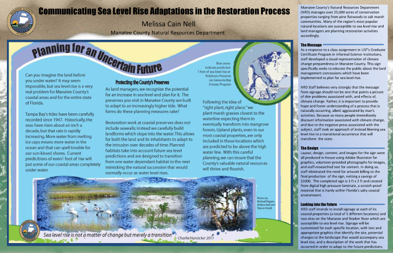
Manatee County's Natural Resources Department manages over 25,000 acres of conservationlan ranging from upland pine flatwoods to coastal salt marsh communities. Many of the region's most popular natural locations are susceptible to sea level rise and land managers are planning restoration activities accordingly. Staff has identified a gap in public perception of local sea level rise adaptation, and seeks to improve awareness by installing signage. This poster describes new climate change educational signage as well as the process of sign development as this resource was created in response to an assignment in USF's ISI Graduate Certificate Program.
File history
Click on a date/time to view the file as it appeared at that time.
| Date/Time | Thumbnail | Dimensions | User | Comment | |
|---|---|---|---|---|---|
| current | 16:06, 3 February 2012 | | 792×509 (271 KB) | 71.41.57.154 (Talk) | (Manatee County's Natural Resources Department manages over 25,000 acres of conservationlan ranging from upland pine flatwoods to coastal salt marsh communities. Many of the region's most popular natural locations are susceptible to sea level rise and land) |
- Edit this file using an external application (See the setup instructions for more information)
File links
The following page links to this file: